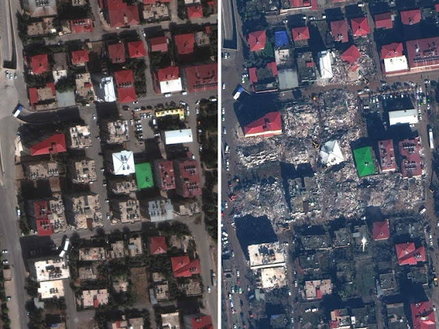
Satellite images of Turkish towns affected by the earthquake show the horrifying extent of the devastation, with homes flattened by the qu...
Satellite images of Turkish towns affected by the earthquake show the horrifying extent of the devastation, with homes flattened by the quake to leave neighbourhoods unrecognisable.
Thousands of buildings have collapsed across Turkey, with nearly 13,000 people now confirmed dead in the country. More than 3,000 have died in Syria.
Rescuers are losing hope of finding more survivors buried under rubble.
Satellite images from Maxar Technologies show how the quake has affected those living in Antakya, in Turkey's southern Hatayn province, as well as communities in Islahiye and Nurdagi, in Gaziantep province.
Antakya
Hatay was the province hit hardest by what was the biggest quake to strike the country since 1939.
Provincial capital Antakya was a thriving multicultural hub, but the destruction caused by the tremor means the city is now unrecognisable.
The images show razed buildings and areas reduced to rubble and emergency tents.
At least 1,200 buildings have been destroyed in the city’s Kirikhan and Iskenderun districts, BBC Turkey reported.
Islahiye
Images of Islahiye show homes flattened, some with their roofs almost intact, amid piles of rubble.


No comments
Thanks